Grab a cuppa (of your favorite beverage) and settle in; this is going to be another photo-heavy post.
By now, it seems impossible that anyone could NOT know about the flooding in the Southwest/Four Corners region. Most of southern Colorado, it seems, has been affected, from the southwestern-most corner all the way to southern (?) San Louis Valley. All of the Four Corners states have been inundated to varying degrees with absolutely gallons and acre-feet and massive cubic-meters-per-second water from rain. I think we’ve been through hurricanes Polo and Rachel and are up to Trudy? Including the four days of rain a week ago, Sunday’s all-day rain added enough to give us about 5 inches in this part of Disappointment Valley. I’m sure people think I’m being evasive when they ask about our “normal” rainfall and I just can’t answer. Nothing is normal anymore. I started coming to Disappointment Valley 24 years ago, and I’m now coming to the close of my 15th year of living here. I don’t often (OK, ever) say that on the blog, but if you haven’t figure it out by now … I live here. 🙂
Damage in various places has been extreme: homes destroyed, highways to forest roads damaged to gone, bridges damaged and gone. You can read about it and hear about it, but SEEING it brings it home. This Colorado Sun article includes several video clips from people showing their views of the flooding in their towns and neighborhoods. That kind of water and flood-related damage makes the flooding in Disappointment Valley look tame. Everything is relative, eh? We didn’t lose any bridges (that I know of), but apparently, there are a couple of Disappointment Creek culverts that are either somewhere between Black Snag Road and the Dolores River … or already washed down the Dolores. (Wouldn’t it be fun to know where they ended up?!)
Let me back up a bit to provide some context. After the rain (well, the aftermath) that I documented in photos here previously last week, resulting in 3.66 inches, it rained all day this past Sunday until almost 8 a.m. Monday. That gave us another 1.39 inches. More rain on top of already-saturated soil … and every creek bed and arroyo and ditch and crack started carrying water. If the ground was “flat” in an area, ponds formed. Lake Disappointment formed again. It flowed over the road again. Sorry, Denny and county guys: It eroded the north side of the road again, just a couple of days after they fixed it (!). I talked to Larry (county to the south) twice in the last two days; he was out checking. Not much they can do yet while the roads are so wet.
Tuesday, water is STILL running, still standing, still everywhere. Even in pictures, I don’t know quite how to convey just how much water is still running through Disappointment Valley.
I went up and down Disappointment Road on Monday, taking about a billion pix (OK, 441). Tuesday morning, I went back down and up the valley. Because I had no time to do anything about those pix last night when I finally returned to the house, I thought I might use this post do do a bit of before (Monday, hours-post-rain-and-flooding) and after (Tuesday morning in the sunshine). So where that works, I’ll do that.
Now … where to start?
Let’s start with the erosion spot that started last week with THAT rain. You’ll remember that Denny and drivers for San Miguel County had been checking that for a few days, then came in with 10-plus dump-truck loads of material to fill it and pack it. At that point, Lake Disappointment (that’s a joke, by the way) had dwindled to Disappointment Pond … and then to just a puddle (which is still saying something as normally, of course, there’s not a spot of water there).
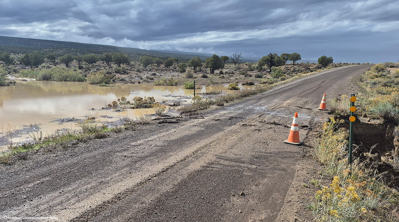
This above was Thursday, Oct. 22, between rain waves. Lake Disappointment, at left/south, was still trickling water across the road to the north side, which was starting to erode.
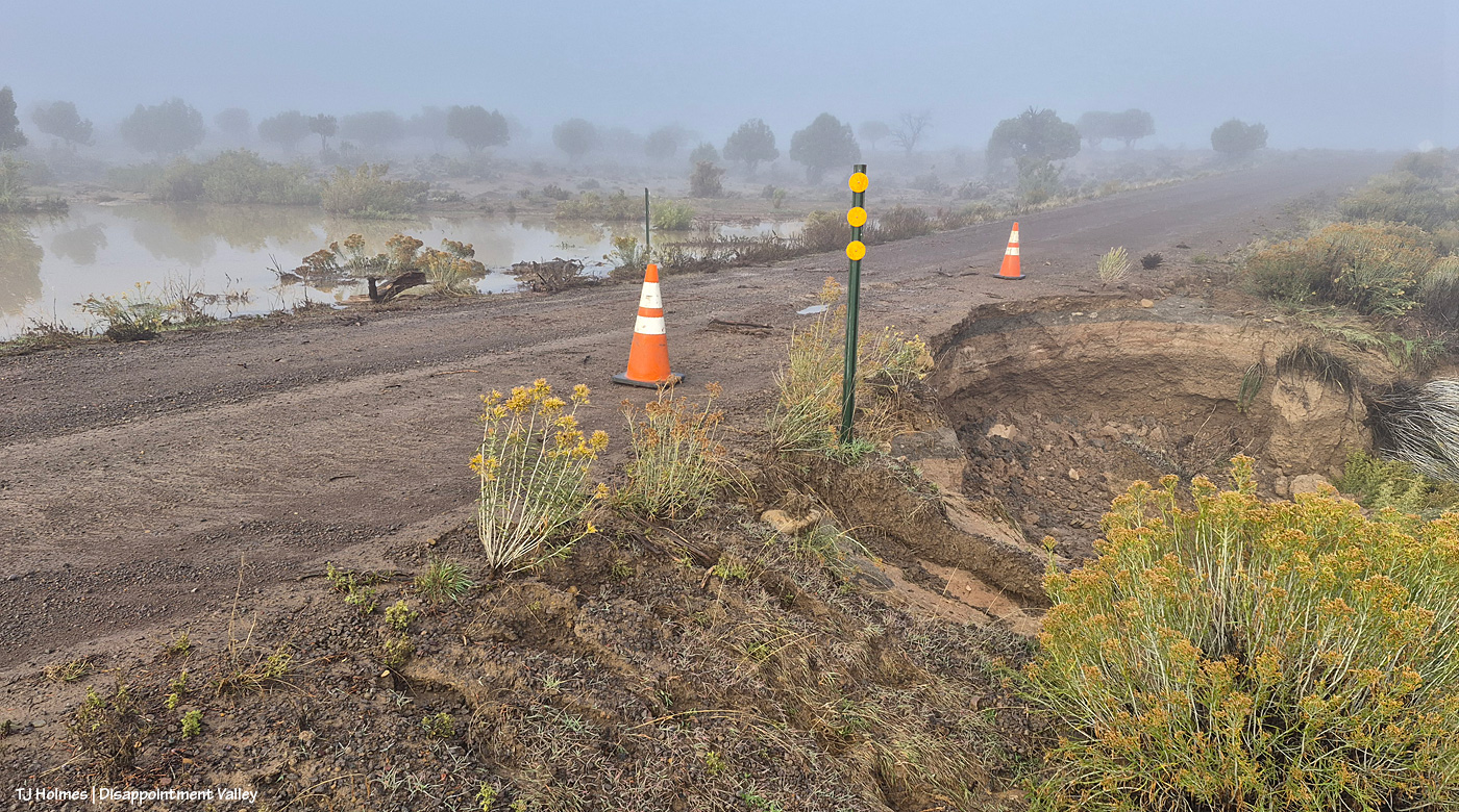
This was Sunday, Oct. 25, as the fog was clearing. Lake Disappointment had receded and was no longer trickling water over the road, but the erosion cut was encroaching even more into the road.
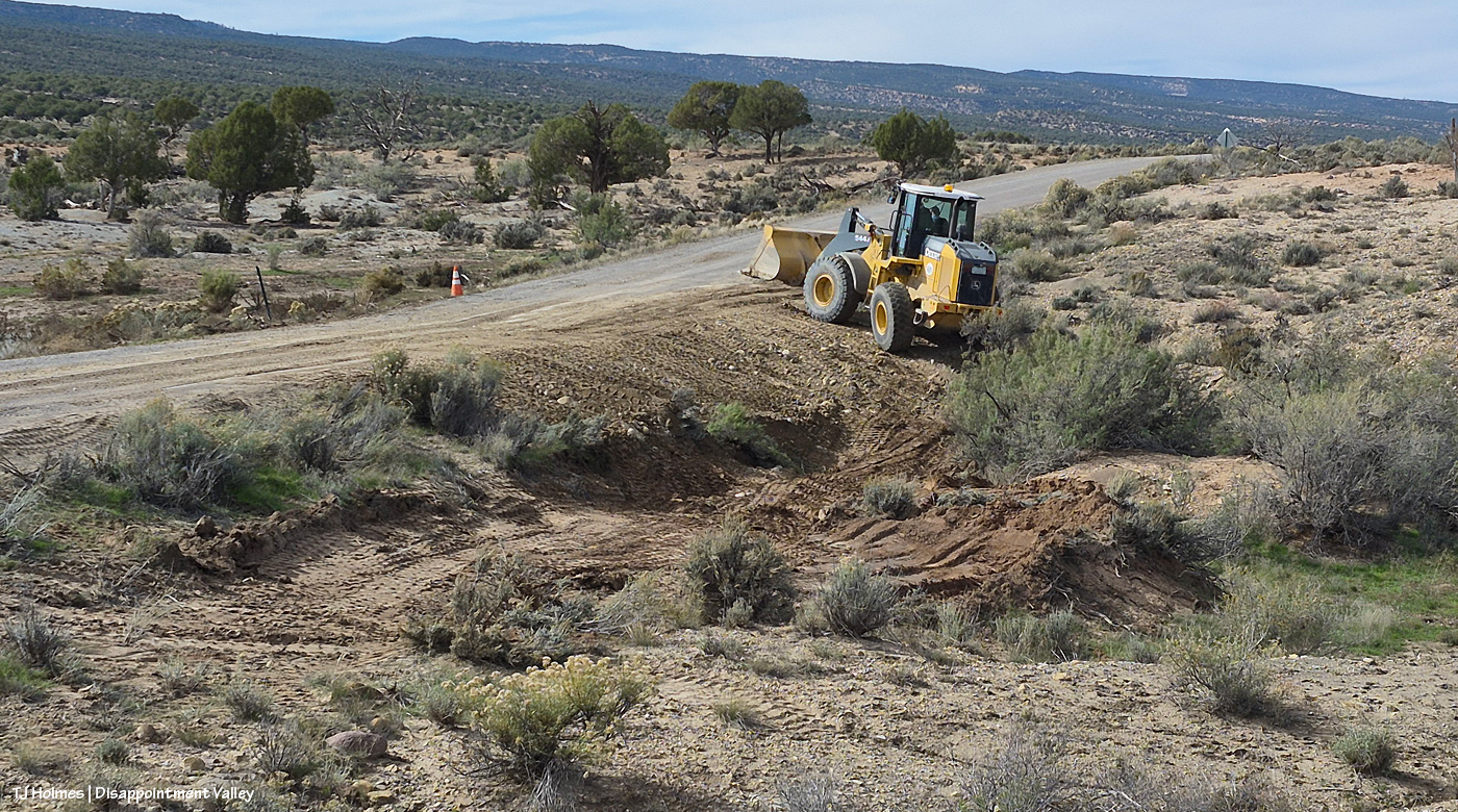
Wednesday, Oct. 28, Denny was working the front-end loader after at least 10 loads of “pit run” (big rocks mixed with dirt).
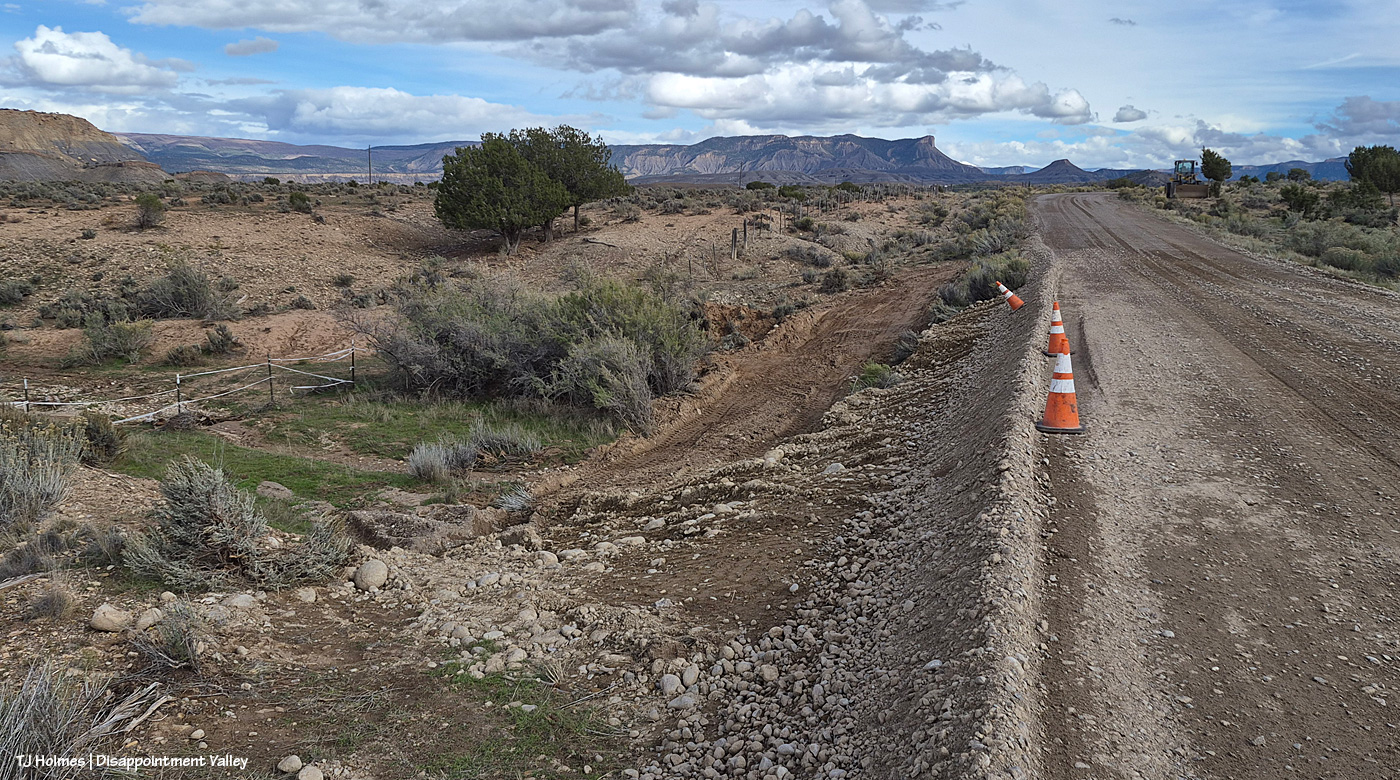
By the time I took this pic Saturday, Oct. 31, the road was looking great. Not only fixed but with more “pit run” with smaller, 3-inch rocks in the dirt to raise the level of the road.
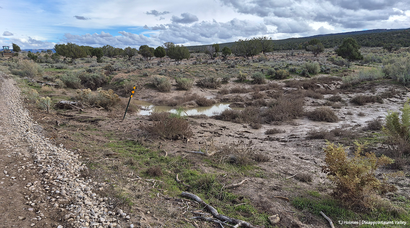
Lake Disappointment, to the right/south of the pic above this one, was down to a bit of a puddle and a lotta mud.
And then it rained from 7:30 a.m. Sunday, Nov. 1, to almost 8 a.m. Monday, Nov. 2.
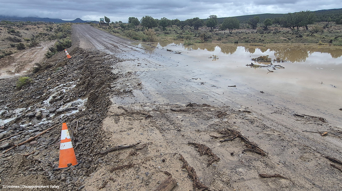
Uh oh. Lake Disappointment refilled overnight (and through the previous day), and this time (Monday, Nov. 2), it really ran over the road (not just trickling), and you’ll notice by the cones in this pic, compared with their locations two pix above, the extent of the erosion already.
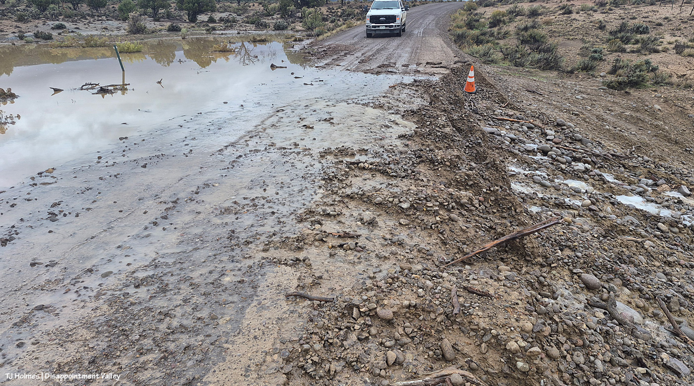
I’ll be the first to tell you to think about a billion times before crossing water over a road, but you know I crossed that water. I COULD see the road under the road, and, well, I had things to look at up the valley.
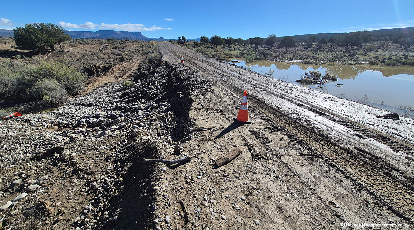
And by Tuesday morning, Nov. 3. Denny was out Monday afternoon to check it, and you’ll notice that he repositioned the cones. I brought the one that washed down back up to the level of the road. (Those are not my truck tracks yet. It was gushy but OK.) Also notice that Lake Disappointment is down a bit again.
Continuing up-valley on Disappointment Road …
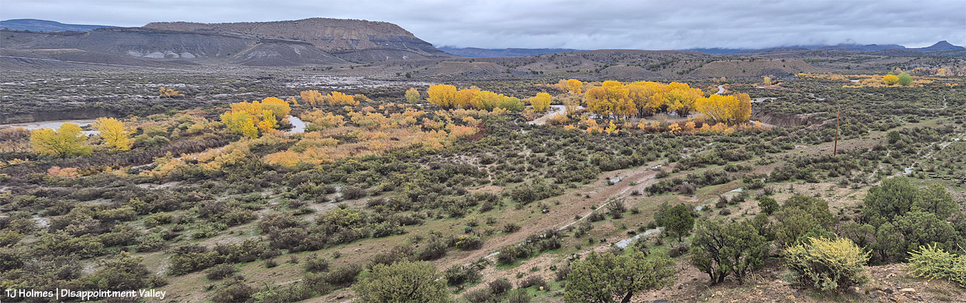
Can you see Disappointment Creek? Of course you can. IT WAS FLOODING!!!!!!
Lemme tell you somethin’: Even when there’s water in Disappointment Creek – even when it’s actually running, a “normal” amount of water, which is usually low compared with what most people think of as a flowing creek – you can’t see the water from here. “Here” is just on the north side of Disappointment Road (the road is to my right, and it continues down the hill and is on the right, outside this image). As wide a view as my phone can capture, this is two images merged together. At leftish are the rimrocks that create the western boundary of Spring Creek Basin. Above/beyond the rimrocks is Filly Peak, inside Spring Creek Basin. At farthest right is Brumley Point, which sits on the basin’s eastern/southeastern boundary. What you can’t see: McKenna Peak and Temple Butte, which are to the left of Brumley, under that low cloud. The rain had stopped about an hourish ago in this pic. Another couple of notes about the image: Disappointment Creek is flowing from far right to far left (southeastish to westish-northwestish), and that clump of cottonwoods at sort of right stands in a big bend of the creek, usually on ground above the flow of the creek. Can you tell that water is running straight through their trunks? Forget the bend in the creek; there was no bend, other than to sort of corral the flow of the water against the high bank; it was all water.
My jaw might have been left on the ground at that point. Pretty sure I left it there for the rest of the trip.
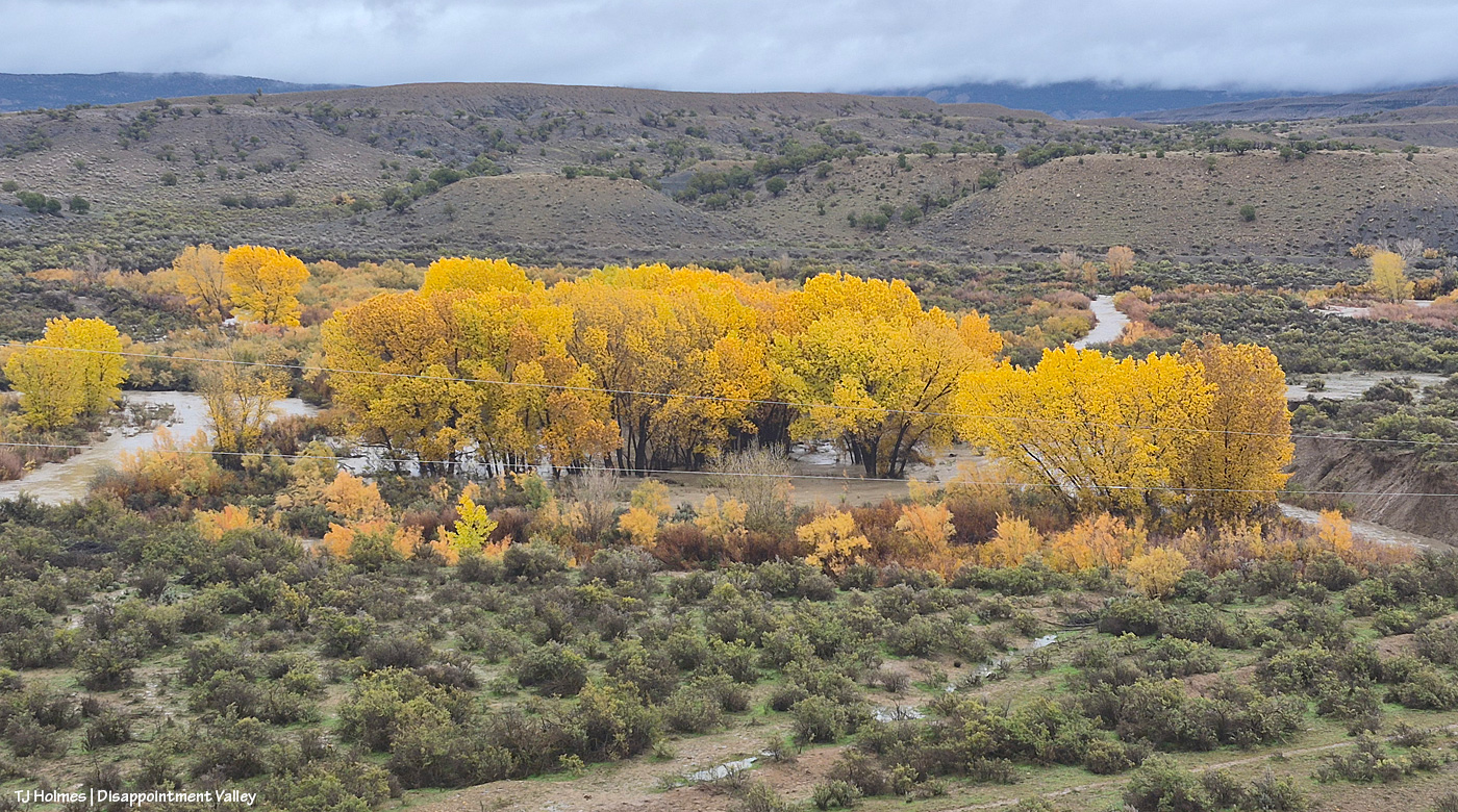
Zoomed-in of that cottonwood cluster (one of my favorites along the whole creek). Oh yeah, and imagine noise. Loud, rushing-water noise. Loud. Normally, you know, it’s pretty quiet in Disappointment Valley.
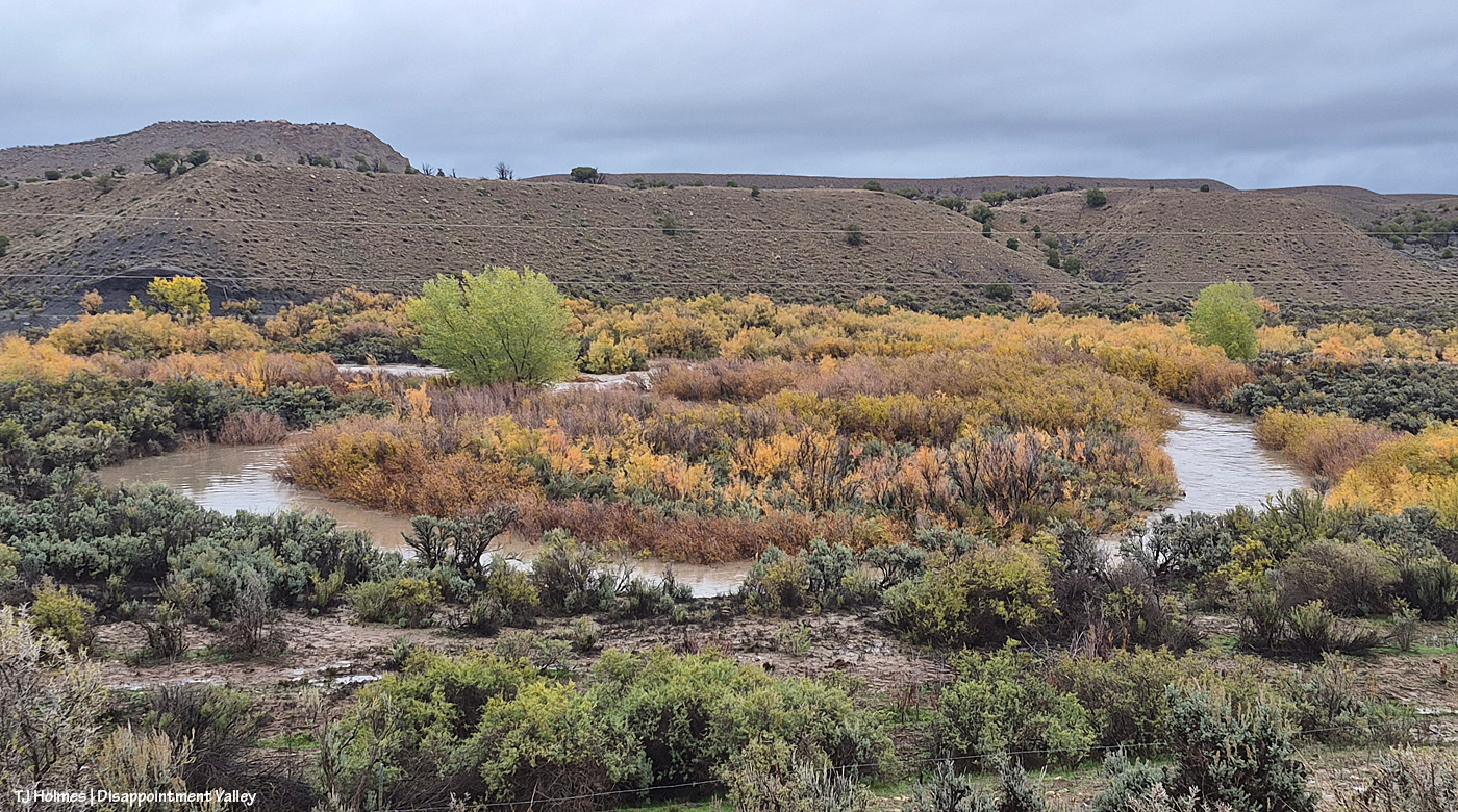
This looks like another nice little bend in the creek, eh? Except that that is NOT part of the actual creek bed!
The above three pix were taken Monday, shortly after the rain stopped that morning. Before we move on, here are two pix of the same places, taken Tuesday (yesterday):
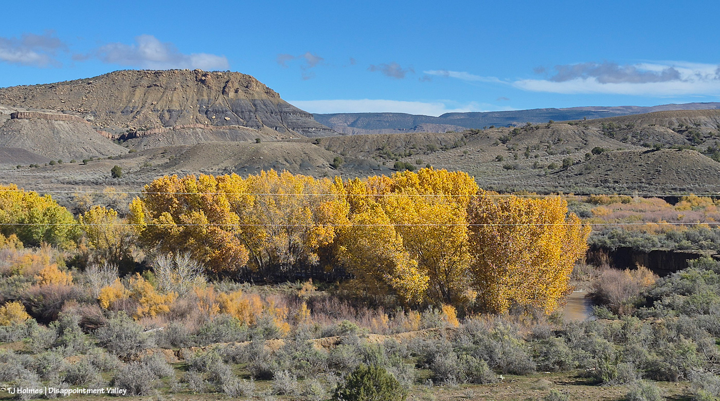
Admittedly, this was taken from the road level, not my previous hilltop-lookout. You can see the water in Disappointment Creek – its normal, regular bed. The water has receded from the ground where the cottonwoods are growing.
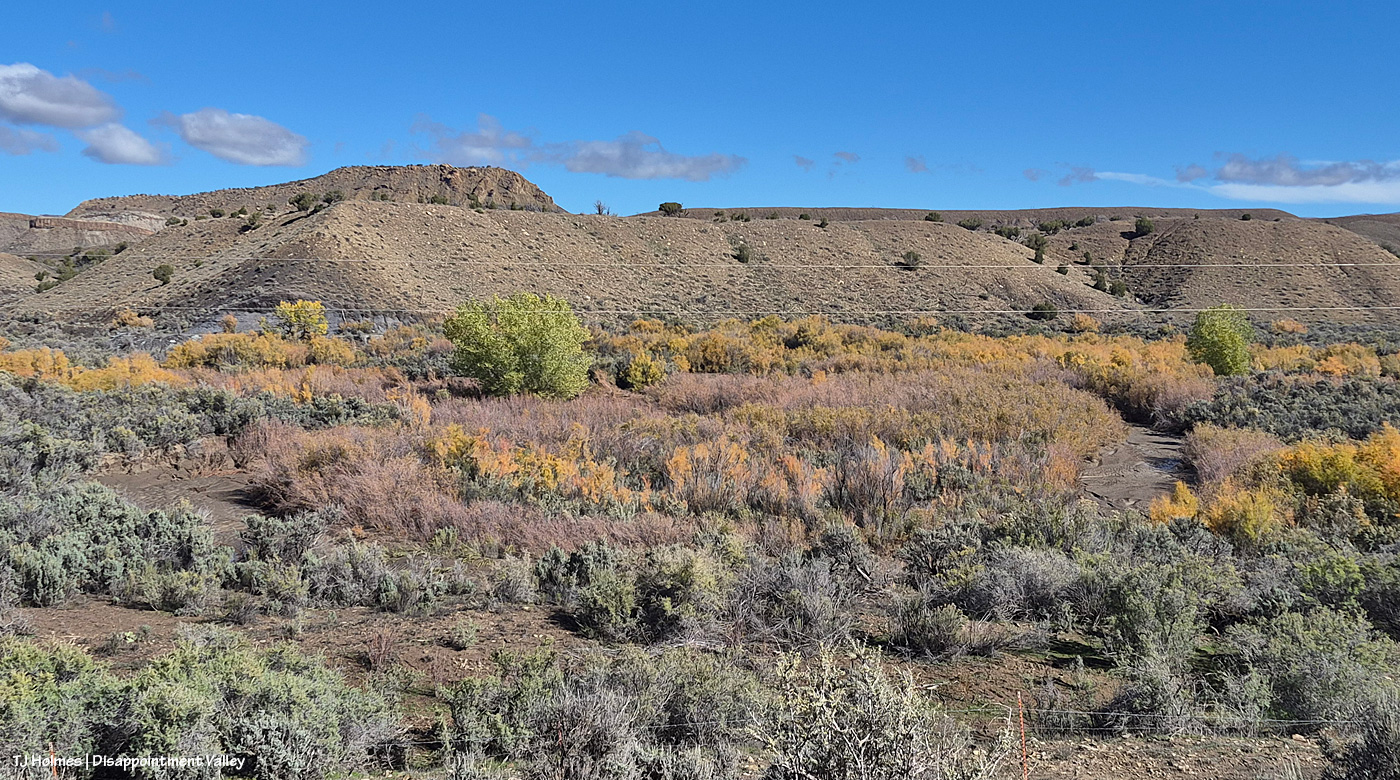
And this is the area shown in the pic above the one above. … What, you don’t recognize it? Look at right – see the mud? Look at left – see the mud? I told you: That was NOT normal creek!
I had plans of going all the way through the befores and afters on my way up-valley … and then Disappointment Creek and Spring Creek down-valley where they flow under Disappointment Road farther west. … But there are a lot of places, and there are a lot of pix, and they’re in different folders (according to date), so I’m going back and forth … and it’s slow-going, and I am not the world’s fastest or most enthusiastic photo editor (technicalities). 🙂 So please hold that thought, and join me again for … let’s call it phase two, and I’ll see how far I get with photo-selecting and -editing to continue on! (Also, I’m mudded out of Spring Creek Basin again for another little while … )


Leave a Reply